This is an automatically translated description
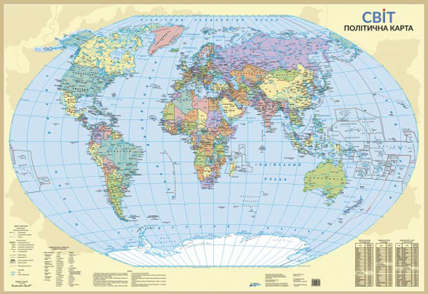
The map shows the current political structure of the world - states and dependent territories.
Contains statistical information presented in the tables:
• the largest countries by population;
• the largest countries by area;
• the largest cities in the world by population.
• For the first time on a political map of the world published in Ukraine, the axial meridian was 30 degrees east, passing near the city of Kyiv, that is, Ukraine is located in the centre of the map.
• Settlements are shown by administrative significance and number of inhabitants.
•
Wall map, printed on paper with matte lamination.
• Scale 1:35 000 000
• Size 98x68 cm